
Park Plan
Consultation has concluded
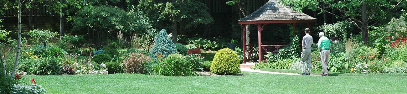
Guelph is growing and the way people use parks is changing. It’s important we plan Guelph’s park system to provide optimal services as our population grows and changes.
This consultation is now closed. Watch for an upcoming report to council
What is a Park Plan?
A Park Plan is needed to ensure we have an optimal level of service for parks that is accessible to all residents as we grow and is sustainable, affordable and realistic.
The Park Plan is a continuation of the parks conversation from the Parks and Recreation Master Plan (PRMP) and aims to address time-sensitive legislative changes to the Parkland Dedication Bylaw required before September 2022.
Parkland dedication alone will not achieve Guelph’s Official Plan parkland targets. The larger PRMP will explore creative solutions to address those goals. The final Park Plan will be integrated into the PRMP and delivered to Council in 2023.
The Park Plan will:
- Define our park system to understand our existing conditions
- Outline future challenges and opportunities facing our park system
- Plan for an optimal level of service as our community grows and changes
- Develop strategic directions for parkland retention, optimization and expansion
We need a Park Plan in order to update our policies and priorities in line with the City’s Strategic Plan and to take advantage of new approaches, legislation, trends and guidelines in park planning and development.
Documents
-
 ParkPlanDraft2022-02-02.pdf (5.34 MB) (pdf)
-
Phase 1 - ParkPlan_EngagmentSum2022-02-01.pdf (265 KB) (pdf)
-
Phase 1 - FocusGroupPresentation.pdf (1.28 MB) (pdf)
-
Phase 1 - Park Plan Public Focus Groups summary.pdf (694 KB) (pdf)
-
Phase 1 - Park Plan Developers Focus Group.pdf (228 KB) (pdf)
-
Phase 1 -Park Plan - Questions and answers from public meetings (156 KB) (pdf)

Who's Listening
-
ML
-

Thank you for this very comprehensive plan.
I'm concerned that there seems to be a sense of resignation that the amount of parkland provided per person going forward will decrease. We cannot afford NOT to provide a large amount of high quality parkland. This report identifies that every $1 spent on trails saves $3 in healthcare costs. Parks improve mental health, attract businesses and professionals to the City, enhance tourism and increase property values and by extension, property tax revenue.
The City needs to have a standard definition of parkland that is used across all departments. Parkland can only refer to "open space". In the Parkland Dedication By-law definition, interpretation has intentionally been left open to include recreation and community centres. Building footprints should not be included when inventorying our parkland. It distorts the picture of how much green space we actually have.
I am also concerned about the accuracy of our inventory. In a study completed several years ago by Matt Saunders, he identified that large areas of the Natural Heritage Areas around the Guelph Lake Sports Fields that the City rents had been included in the parkland inventory. There were also numerous cases where building footprints were included in the parkland inventory.
It is clear from this report that growth of parkland is not keeping up with population growth. Without the windfall of the Eastview landfill site being converted to parkland, we wouldn't be close to our targets. Another reason that we are anywhere near our targets is that they were moved. Prior to OPA 48, the parkland targets were 1.5 ha/1000 people for Neighbourhood parks, 1.8 ha/1000 people for Community parks and 5.5 ha/1000 people for Regional parks, a total of 8.8 ha/1000 people. In the Official Plan update, those targets were changed to 0.7 ha, 1.3 ha and 3.3 ha respectively, a total of 5.3 ha. We cannot continue to "meet our targets" by changing the targets themselves!
Citizens need to see follow through on the plans that have already been made. What is happening with the planned park at Wellington and Gordon Streets along the river? According to the DSP, that land is supposed to be acquired this year. Staff should have been monitoring downtown intensification and the ration of population to parks to clearly understand the timing of the need for that park. The downtown has been rapidly intensifying, but the corresponding additional parkland has not come online.
Developers need to contribute the maximum parkland or cash-in-lieu allowed under the Planning Act. Guelph's natural and built heritage and park networks add to the profitability of their real-estate offerings. Parkland needs to grow along with the population. Developers should not be maximizing their profits at the expense of the quality of life of current and future residents.
The City needs to take advantage of the last available opportunities to provide regional parks on the Reformatory lands and in Clair-Maltby. If we do not set aside parkland now, we will have closed the door on the opportunity for future generations to have sufficient parkland.
I shared my thoughts, but they seem to have disappeared. Will you include them? Susan Ratcliffe
The Plan ignores the fact that the crown jewel of Royal City Park is the sheet of water that is the Speed River, and the recreational boating that is enjoyed on it by thousands of resident boat owners and by tourists each year. Guelph has this precious recreational resource in the midst of its parks only because the river is made navigable over 5 kilometres (nearly to Stone Road East) for 5 months a year by the GRCA-owned Wellington Street Dam.
The GRCA seeks to have the dam removed, as it has no water management function and therefore does not fit with its Strategic Plan. To do this, it budgeted for an Environmental Assessment and is seeking funding to commence it. When asked, GRCA declined to commit to making a fair valuation of the amount of benefit that the dam and reservoir offer to boaters within the EA process....thereby unfairly skewing the process so as to result in a removal of the dam. It has allowed cosmetic maintenance to paint and concrete to slide. This is in contrast to 25 other small dams that it operates, none of which have a water management purpose, but all of which are excellently maintained by GRCA. Some examples are in New Hamburg, Wellesley, New Dundee and Cambridge (Parkhill Dam.) Yet none of these or the other 21 dams offer a recreational benefit nearly as significant as the Wellington Street Dam does to Guelph.
The explanation for this situation can only be that other municipal Councils (and perhaps their staffs as well) have told the GRCA in no uncertain terms that they want their dams to remain and to be maintained by GRCA. Guelph Council has not, perhaps because the issue has never been brought before it. However, the Park Plan offers an opportunity to do so.
But since 2008, GRCA has repeatedly hectored the City to assume ownership of the dam. It appears the City has demurred and that the GRCA then opted to force the issue by budgeting for the EA in 2018. But it appears the City has not reacted to this prospect or likelihood of the dam being removed as an outcome of an EA being initiated by GRCA.
A suggested solution to this apparent impasse:
( at the least) ...City COUNCIL should formally request the GRCA to shelve the idea of commencing an EA; affirm that it wishes to dam to remain in service; and it should request that GRCA complete the overdue cosmetic maintenance of paint and concrete as a prerequisite to any further talks on the transfer of ownership of the dam to the City.
I support the details outlined in many of the other comments regarding the swath of land on both sides of the Eramosa River and up onto the cliff top from Victoria road to Stone Road. Looking at the Natural Heritage map this entire section is considered a 'Significant Natural Area'. However, some of the existing trails are not encompassed in this NH area. The new parks should envelop and protect these trails. These trails are a significant part of connectivity in this area. The parks should be part of that connectivity. This should be part of a system that connects Stone Road West over at Crane Park all along the Speed River and up the Eramosa River to Stone Road East and have a complete connected Parkway. The city just annexed the quarry to make way for the western connection along the river, this eastern GID piece should be captured within parks and be protected from development to complete the eastern connection.
The GID Mobility Plan does not include a significant amount of existing and well used trails. See here: https://guelph.ca/wp-content/uploads/Official-Plan-Consolidation-June-2021.pdf#page=360
Royal City Park's crown jewel and literal centrepiece is the Speed River, or more accurately, the sheet of water impounded by GRCA's Wellington Street Dam. The dam is what makes the Speed and Eramosa into 5 km of navigable river from Victoria Day to Thanksgiving, extending to nearly Stone Road East. Thousands of Guelphites own canoes and kayaks that ply the river. Thousands more rent boats each year at The Boathouse (35% being tourists.)
The major recreational benefit offered by this navigable water resource located inside the Park (and from Eramosa River Park) does not seem to have been recognized by the Parks Plan.
The dam is in danger of being removed. The GRCA has budgeted for and is seeking funds to begin an environmental assessment to remove (or repair) the dam. Yet, when asked, it has declined to provide assurance that the tangible worth of the recreational benefits the dam provides will be factored into the EA study. GRCA head office staff purport to City staff that major maintenance will be needed; but long-time GRCA dam maintenance staff assured me that only some minor cosmetic repairs to paint and concrete are needed. Yet these repairs have been let slide by GRCA, while all other 25 GRCA smaller dams of FAR less recreational value are everywhere very well maintained (e.g..New Dundee, New Hamburg, Wellesley, Cambridge (Parkhill) ). Why is that?
For over 13 years, the GRCA has hectored the City to assume ownership of the dam, since the recreational amenity it provides no longer fit with its Strategic Plan. The City has apparently demurred these entreaties. The GRCA has responded with its EA proposal to force the issue. The apparent impasse will require the attention of COUNCIL, as the matter appears to not have been brought to their attention to date.
But one thing is clear: the 25 other small GRCA dams that provide neither water management nor significant recreational benefits are only being maintained by GRCA because the municipal COUNCILS (and presumably the municipal staffs) TOLD GRCA in no uncertain terms that they wanted these dams to remain and to be maintained by GRCA.
RECOMMENDATION: as a minimum, that staff and Council inform gRthe position that the EA proposal should be shelved by GRCA, and that any further talks on possible transfer of ownership to the City can only resume after the cosmetic repairs to paint and concrete have been completed by GRCA.
Failing that, the most probable scenario is that the dam will be eventually decommissioned, the river becomes instantly unnavigable as a result, and the recreational and tourism benefits to the City and to Guelphites is lost. (GRCA of course will benefit from canoeists being obliged to pay to get into Guelph Lake instead.)
(And without the crown jewel of a navigable river, Royal City Park should be reclassified in the plan from a Regional Park to just another Community Park.)
The map of proposed parks shows one immediately to the south of the Pearson ball diamond complex. But a far more useful and attractive feature is located immediately to the west ....a kettle lake, surrounded by 30 acres of what was once rough pasture that is now slowly growing up in buckthorn. Owned by TDL Corp (Tim Horton warehouse) to the west, the area is being taken up by MTB riders and their trails. However, it would be a very scenic addition to the park, with a trail looping about the lake. The property is designated NHS even though nothing in the land base is significant or senstive, aside from the lake itself. Parks should breach the great divide that the City has created for itself by deeming NHS as no-go areas as parks, and add this to the existing park complex. Doubtless TDL would be happy to get a tax receipt for donating the land to the city since it is undevelopable. And the park would benefit by adding a jewel that would truly make it a Regional Park.
I am opposed to the City's designation of Oak Street Park as a stormwater ponding / storage facility, as is proposed in the Stormwater Master Plan. This storage capacity should instead be created further downstream in the sewer-shed on the many office and commercial parking lots along Stone West.
The plan should include an intent to enrich the user experience by interpreting aspects of the park, be they heritage, geology, etc. For instance, SW Ontario's first esker lies within University Village and Preservation Parks, but are unknown to the public . Eramosa River Park contains a buried 125 foot deep gorge, (located beneath the waterworks) that was filled in by the last Ice Age. The Eramosa and Silver Creek Parks are located in The Guelph Spillway, the largest in Southern Ontario. The City has many qualified staff in environmental planning, parks, and museums who could be engaged in such an initiative.
I fully support the previous comments about maintaining access to the cliff top trail. It is an artery for hikers and cyclists and its use has only increased in the last few years.
Hello out there. Looking at the map, I notice that the trails running along the eramosa east of Victoria are not shown as parkland. Would there be an option to have that designated out to stone road? I know many in the cycling, running, hiking community use those trails quite heavily to create a loop, to access the smith property, and to make their way to the hiking club / GORBA trails further south along Watson.
Cheers
The clifftop trail is a major connector to other trails in the area. One of my favourite loops is to take the clifftop trail by the former Turfgrass lands, cross the river at Stone road, and then return via the trail that goes through the Yorklands that is maintained by the Guelph Hiking club. It's a very popular loop, and without the access along the clifftop trail there would be no loop, making the other trails in the area less desirable since they would simply be "out and back".
Also as someone who doesn't own a car, I use the clifftop trail to access the trails on Watson past Arkell. It's a major link for cyclists, hikers, and joggers to other trails in the area. There is such a high demand for trails these days, we should do whatever it takes to keep the existing trails in Guelph.
The upper ridge trail (in the GID )above the lower Radial Trail on the South side of the Eramosa River must be maintained for vital trail network connectivity. This will enable future residents of the GID to walk or bike in many directions for recreational and practical tasks .It will enable the concept of the 15 minute neighbourhood.
The developer has already promoted these lands as "Walkable" and a "City within a City"
The upper Ridge trail will connect the GID to a proposed restored trestle bridge over the Eramosa . It will also connect the proposed GJR rail /pedestrian bridge grade level crossing over the Eramosa along with a future short pedestrian bridge over Clythe Creek. Both bridges and the Upper ridge trail will then be able to connect to the Yorklands trail system and from there to the planned MUPS on York road. At the area of the York and Victoria road intersection the proposed TCT extension along the GJR to Victoria will provide a direct enjoyable and safe AT connection to Downtown ,GO etc.
Trans Canada Trail staff have indicated that the availability for funding for the TCT extension increases with the extension being well connected to other trail network systems and loops.
Mike Darmon President
Guelph Coalition for Active Transportation (GCAT .ca)
The ridge along the Eramosa River Valley has been a favourite place for active citizens of Guelph for decades. I have personally been running on these trails since the early 80s. It is important that we preserve these trails in their current state so that cyclists, runners and hikers can continue to enjoy them. They are a critical link to other trail networks.
I fully support the comments left by bcoomber and symbol. CIL should be at least as, preferably more, costly to developers than land dedication. Why 1ha per 300 DU for land but only 1ha per 500 DU for CIL?
In either case - land transfer or CIL - we should be requiring the maximum amount allowed by the province. Developers are doing just fine - their growing profits shouldn't thwart our access to green space.
To quote MTGuelph, 'The Park Plan mentions three proposed parks in the GID. However, no mention is made of the trail and tract of land along the ridge above the Eramosa River Valley. This trail is well used and much loved. Every effort must be made to preserve it, and the land surrounding it, for public access.' My friends and I use this trail often and it is one of the more enjoyable trails in Guelph. Pls ensure it is kept free for public use. Even better, make it a condition that any developer maintain and improve the trail in perpetuity. :-)
Hi,
I am a frequent user of the clifftop trail along the former Guelph turfgrass. I hope with the new development of the area the citizens of Guelph will have continued access to this important area of land.
The Park Plan mentions three proposed parks in the GID. However, no mention is made of the trail and tract of land along the ridge above the Eramosa River Valley. This trail is well used and much loved. Every effort must be made to preserve it, and the land surrounding it, for public access.
The GID Secondary Plan, section 11.2.2, states that:
“Roads and trails will be designed along the edge of the Eramosa River Valley to provide opportunities for a public edge, public views and greater protection opportunities. The Natural Heritage System shall be protected, maintained, restored and enhanced so that it may fill its role as the centerpiece of the GID.”
We must ensure that public access is maintained along the edge and that it is not in the form of a road - roads adjacent to NHS do not protect, maintain, restore or enhance the NHS, or peoples’ experience of such. A well managed and maintained trail provides a sustainable and suitable opportunity to provide public views and a public edge. The Park Plan should state that every effort will be made to preserve the ridge top trail and surrounding land, preferably as a naturalized area within a community park.
As the draft Park Plan states (pg 19):
“Almost half of survey respondents believe that adding or improving trails is the best way to provide recreation in our community to adults, youth and seniors.”
Let’s make sure that we don’t lose a trail that is so popular with Guelph residents.
Please amend and remove the parkland dedication tax for infill developments, i.e single detached homes. Individuals that which to remove a dwelling and rebuild are being arbitrarily taxed as per, e) Where Land in the City is to be Developed or Redeveloped for any use other than commercial, industrial, or residential, a portion of the Land not exceeding five percent (5%) of the total area of the Land shall be conveyed to the City for Parkland.
In reviewing your Park Plan, I see a disconnect between your difficulty in maintaining our current park standards and then not considering innovative park provision mechanisms (POPs) as a way to provide new park space (pg 105 of report). There may be instances where small areas (tot lots; small dog runs, etc.) would be useful for this. All available mechanisms should be explored in an increasingly intensified City rather than accepting a lower parkland standard.
I agree with what others have said. I was disappointed to see that CIL rates were actually LOWER than what would be required for dedicating land directly. I think it would make more sense for CIL to be at a higher rate to both incentivize direct land dedication and to offset the effect of land costs increasing between the time the money is received and the time the land is purchased.