
Silvercreek Parkway North reconstruction
Learn about how we are improving Silvercreek Parkway North.
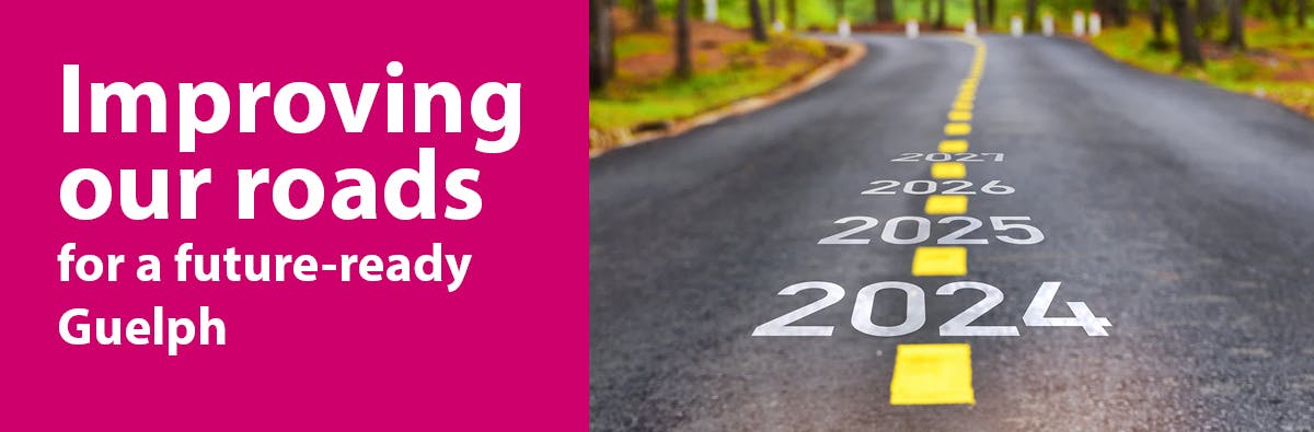
We are replacing sanitary sewers and watermain pipes, and improving the roadway with new curbs and multi-use paths between Speedvale Avenue West and Woodlawn Road. The Guelph Junction Railway crossings will also be upgraded to meet Canadian Railway Standards. This project will be constructed in two phases, Phase 1 will commence in Summer 2023 and Phase 2 will commence in Spring 2024.

Read the project information package and view the PowerPoint presentation and detailed design to learn about the improvements and the reconstruction details. If you have questions or comments about this upcoming work use the questions and comments tools below. You can ask questions or provide comments up to and during construction.
Learn about how we are improving Silvercreek Parkway North.
We are replacing sanitary sewers and watermain pipes, and improving the roadway with new curbs and multi-use paths between Speedvale Avenue West and Woodlawn Road. The Guelph Junction Railway crossings will also be upgraded to meet Canadian Railway Standards. This project will be constructed in two phases, Phase 1 will commence in Summer 2023 and Phase 2 will commence in Spring 2024.
Read the project information package and view the PowerPoint presentation and detailed design to learn about the improvements and the reconstruction details. If you have questions or comments about this upcoming work use the questions and comments tools below. You can ask questions or provide comments up to and during construction.
Silvercreek Parkway North questions
If you have any questions about the Silvercreek Parkway North project please ask us here. We will do our best to answer your questions within three business days.
-
Share What is the start date for this? My understanding was May and we are now half way through June. Businesses here are trying to prepare and with an unknown start date we are unable to prepare our clients. Thank you. on Facebook Share What is the start date for this? My understanding was May and we are now half way through June. Businesses here are trying to prepare and with an unknown start date we are unable to prepare our clients. Thank you. on Twitter Share What is the start date for this? My understanding was May and we are now half way through June. Businesses here are trying to prepare and with an unknown start date we are unable to prepare our clients. Thank you. on Linkedin Email What is the start date for this? My understanding was May and we are now half way through June. Businesses here are trying to prepare and with an unknown start date we are unable to prepare our clients. Thank you. link
What is the start date for this? My understanding was May and we are now half way through June. Businesses here are trying to prepare and with an unknown start date we are unable to prepare our clients. Thank you.
HR asked 11 months agoYou are correct, this project was originally planned to commence in May 2023. The scope and schedule of this project have been revised and the portion of the work proposed from Woodlawn Road to Campbell Road is anticipated to commence in July 2023. The second phase of this project, Campbell Road to Speedvale Ave W, is anticipated to start in Spring 2024.
-
Share With the proposed (now approved) new apartment buildings on the lot near Leon's/NoFrills, traffic in the area is likely to increase considerably. What is the City's plan to keep pedestrials safe further south near the existing exit from that plaza? I quite often see pedestrians crossing mid-block and having to sprint for their lives through the confusion of the traffic and turning lanes. At night in winter or when it's raining, it is very hard to spot them while also looking out for cars changing lanes and turning into and out of the many other plazas in that short stretch. on Facebook Share With the proposed (now approved) new apartment buildings on the lot near Leon's/NoFrills, traffic in the area is likely to increase considerably. What is the City's plan to keep pedestrials safe further south near the existing exit from that plaza? I quite often see pedestrians crossing mid-block and having to sprint for their lives through the confusion of the traffic and turning lanes. At night in winter or when it's raining, it is very hard to spot them while also looking out for cars changing lanes and turning into and out of the many other plazas in that short stretch. on Twitter Share With the proposed (now approved) new apartment buildings on the lot near Leon's/NoFrills, traffic in the area is likely to increase considerably. What is the City's plan to keep pedestrials safe further south near the existing exit from that plaza? I quite often see pedestrians crossing mid-block and having to sprint for their lives through the confusion of the traffic and turning lanes. At night in winter or when it's raining, it is very hard to spot them while also looking out for cars changing lanes and turning into and out of the many other plazas in that short stretch. on Linkedin Email With the proposed (now approved) new apartment buildings on the lot near Leon's/NoFrills, traffic in the area is likely to increase considerably. What is the City's plan to keep pedestrials safe further south near the existing exit from that plaza? I quite often see pedestrians crossing mid-block and having to sprint for their lives through the confusion of the traffic and turning lanes. At night in winter or when it's raining, it is very hard to spot them while also looking out for cars changing lanes and turning into and out of the many other plazas in that short stretch. link
With the proposed (now approved) new apartment buildings on the lot near Leon's/NoFrills, traffic in the area is likely to increase considerably. What is the City's plan to keep pedestrials safe further south near the existing exit from that plaza? I quite often see pedestrians crossing mid-block and having to sprint for their lives through the confusion of the traffic and turning lanes. At night in winter or when it's raining, it is very hard to spot them while also looking out for cars changing lanes and turning into and out of the many other plazas in that short stretch.
EternalOptimist asked about 1 year agoThank you for noting concerns about pedestrian safety and access in the area of the plaza on Silvercreek Parkway North between Speedvale Avenue and Willow Road. Your comments have been shared with Transportation Planning staff, who will be reviewing and commenting on the proposed development at 111-193 Silvercreek Parkway North once it comes forward as a Site Plan Application.
-
Share Will the multi use pathways be extended south to Paisley? I would like to ride my bike in the area, but it feels unsafe. on Facebook Share Will the multi use pathways be extended south to Paisley? I would like to ride my bike in the area, but it feels unsafe. on Twitter Share Will the multi use pathways be extended south to Paisley? I would like to ride my bike in the area, but it feels unsafe. on Linkedin Email Will the multi use pathways be extended south to Paisley? I would like to ride my bike in the area, but it feels unsafe. link
Will the multi use pathways be extended south to Paisley? I would like to ride my bike in the area, but it feels unsafe.
campbelltsommerville asked about 1 year agoThe multi-use pathways will only go as far south as Speedvale Road as part of this project. There are currently bike lanes on Silvercreek Parkway North from Speedvale Avenue to Willow Road, and bike lanes are also planned for installation during 2023 on Silvercreek Parkway North from Willow Road to Paisley Road. Thank you for sharing your comment about feeling unsafe to cycle in this area. Many residents of our city want to feel more comfortable and secure when cycling in Guelph, and we recognize that cycling facilities that are fully separated from vehicle traffic, such as cycle tracks or multi-use paths, offer the best level of comfort for people to cycle. In response, we are developing plans for a protected cycling network that will connect large parts of our community and help all riders feel comfortable biking along key streets in Guelph. Silvercreek Parkway North is part of the planned Cycling Spine Network under Guelph’s new 2022 Transportation Master Plan. This means that in the future, the bike lanes on Silvercreek Parkway will be upgraded to become protected cycling facilities suitable for all ages and abilities (AAA). To find out more about the Transportation Master Plan please visit: https://guelph.ca/plans-and-strategies/transportation-master-plan/tmp-documents/.
-
Share Thanks, that's great news about the bike lanes north of Silvercreek. Does the City communicate/coordinate with the County? It would be great if the County could also put in bike lanes when they re-asphalt Silvercreek, at least between the G2G trail and Guelph City limits. on Facebook Share Thanks, that's great news about the bike lanes north of Silvercreek. Does the City communicate/coordinate with the County? It would be great if the County could also put in bike lanes when they re-asphalt Silvercreek, at least between the G2G trail and Guelph City limits. on Twitter Share Thanks, that's great news about the bike lanes north of Silvercreek. Does the City communicate/coordinate with the County? It would be great if the County could also put in bike lanes when they re-asphalt Silvercreek, at least between the G2G trail and Guelph City limits. on Linkedin Email Thanks, that's great news about the bike lanes north of Silvercreek. Does the City communicate/coordinate with the County? It would be great if the County could also put in bike lanes when they re-asphalt Silvercreek, at least between the G2G trail and Guelph City limits. link
Thanks, that's great news about the bike lanes north of Silvercreek. Does the City communicate/coordinate with the County? It would be great if the County could also put in bike lanes when they re-asphalt Silvercreek, at least between the G2G trail and Guelph City limits.
AieshaM asked over 1 year agoThe County may have a different approach to cycling facilities than the City of Guelph. The City will communicate to the County that they have received communications requesting cycling facilities, however, the choice to implement the facilities or not is ultimately up to the County.
-
Share Hi. My question isn't quite about this project, but related. Are there plans to put in a bike lane on Silvercreek north of Woodlawn, and, if so, what is the timing on that? on Facebook Share Hi. My question isn't quite about this project, but related. Are there plans to put in a bike lane on Silvercreek north of Woodlawn, and, if so, what is the timing on that? on Twitter Share Hi. My question isn't quite about this project, but related. Are there plans to put in a bike lane on Silvercreek north of Woodlawn, and, if so, what is the timing on that? on Linkedin Email Hi. My question isn't quite about this project, but related. Are there plans to put in a bike lane on Silvercreek north of Woodlawn, and, if so, what is the timing on that? link
Hi. My question isn't quite about this project, but related. Are there plans to put in a bike lane on Silvercreek north of Woodlawn, and, if so, what is the timing on that?
AieshaM asked over 1 year agoThe section of Silvercreek Parkway North from Woodlawn Road to City Limits is planned to be rehabilitated in 2023 as part of the City's Annual Asphalt program. During this work there will be additional width added to the asphalt surface to provide bike lanes for the entire length section. The 2023 Annual Asphalt contract has not yet been awarded so the specifics of the timeline for implementation have not been determined at this point.
bike lanesbike lanes -
Share I see the existing comment about adding trees to the boulevard, and the response about overhead and underground utilities. However, is there no option to add smaller species such as hedges, shrubs, bushes, or dwarf trees (for example, red osier)? These could still act as a buffer to sun, noise, dust, and even erosion, without having a maximum size that would threaten infrastructure. Thanks for considering. on Facebook Share I see the existing comment about adding trees to the boulevard, and the response about overhead and underground utilities. However, is there no option to add smaller species such as hedges, shrubs, bushes, or dwarf trees (for example, red osier)? These could still act as a buffer to sun, noise, dust, and even erosion, without having a maximum size that would threaten infrastructure. Thanks for considering. on Twitter Share I see the existing comment about adding trees to the boulevard, and the response about overhead and underground utilities. However, is there no option to add smaller species such as hedges, shrubs, bushes, or dwarf trees (for example, red osier)? These could still act as a buffer to sun, noise, dust, and even erosion, without having a maximum size that would threaten infrastructure. Thanks for considering. on Linkedin Email I see the existing comment about adding trees to the boulevard, and the response about overhead and underground utilities. However, is there no option to add smaller species such as hedges, shrubs, bushes, or dwarf trees (for example, red osier)? These could still act as a buffer to sun, noise, dust, and even erosion, without having a maximum size that would threaten infrastructure. Thanks for considering. link
I see the existing comment about adding trees to the boulevard, and the response about overhead and underground utilities. However, is there no option to add smaller species such as hedges, shrubs, bushes, or dwarf trees (for example, red osier)? These could still act as a buffer to sun, noise, dust, and even erosion, without having a maximum size that would threaten infrastructure. Thanks for considering.
Lee A asked over 1 year agoThank you for your comment. The City is strongly in support of increasing our tree canopy and providing more comfortable spaces for those travelling on our active transportation network. Unfortunately due to space constraints between the roadway, ditches and hydro poles there is not much opportunity to include trees along the multi-use paths. There is opportunity to add trees on the back side of the ditch and this possibility is being reviewed with Urban Forestry to identify what the optimal locations for trees would be behind the ditches and away from hydro lines.
treestrees -
Share Is there space to move the paths a little bit and to put trees between the road and the path? It would make the path more pleasant to use. on Facebook Share Is there space to move the paths a little bit and to put trees between the road and the path? It would make the path more pleasant to use. on Twitter Share Is there space to move the paths a little bit and to put trees between the road and the path? It would make the path more pleasant to use. on Linkedin Email Is there space to move the paths a little bit and to put trees between the road and the path? It would make the path more pleasant to use. link
Is there space to move the paths a little bit and to put trees between the road and the path? It would make the path more pleasant to use.
FConibear asked over 1 year agoHi FConibear,
Thank you for the question. The potential to add boulevard trees, especially to our active transportation corridors, has been a topic in design discussions throughout the City. Unfortunately for this project there are several constraints that prevent this option from being feasible. Most importantly, the overhead hydro lines on the west side of the road prevent us from planting any trees due to the potential interference with the utility. Additionally on both sides of the road there are currently large drainage ditches which take up a significant portion of the existing right-of-way, with buried utilities on both sides of the ditches. In order to provide enough space for boulevard trees between the multi-use path and the roadway it would be necessary to enclose these ditches in a major storm sewer system, which would expand the scope of the project significantly to the point where it would become infeasible to complete this work within the allotted timeframe. Boulevard trees will continue to be considered on other projects to increase the City's canopy and continue to improve our public spaces.
treestrees -
Share What is a multi-use path way? Is it the same as the pathway on both sides of Woodlawn rd.? on Facebook Share What is a multi-use path way? Is it the same as the pathway on both sides of Woodlawn rd.? on Twitter Share What is a multi-use path way? Is it the same as the pathway on both sides of Woodlawn rd.? on Linkedin Email What is a multi-use path way? Is it the same as the pathway on both sides of Woodlawn rd.? link
What is a multi-use path way? Is it the same as the pathway on both sides of Woodlawn rd.?
JluvBiking asked over 1 year agoHi JluvBiking,
A multi-use pathway is a form of active transportation infrastructure that provides space for pedestrians and cyclists to both use as mixed traffic. Multi-use pathways are built using asphalt with a 3 metre wide platform. This form of AT infrastructure is typically used in locations where the amount of pedestrian and cycling traffic is low enough that the two modes can reasonably share the path without too many conflicts.
The Silvercreek Multi-Use Pathways will be in the same style as the Woodlawn Multi-Use Pathways and will connect at the Silvercreek and Woodlawn intersection, allowing for smooth connection between the two paths and creating a separated active transportation connection between the Woodlawn Multi-Use Pathways and the Silvercreek Parkway bike lanes south of the Speedvale Avenue West intersection. This will create a nearly continuous cycling connection from the Woodlawn Road Multi-Use Pathway system to downtown via Silvercreek Parkway North, Willow Road, Edinburgh Road, London Road, Woolwich Street and Norfolk Street.
cyclinginfrastructurecyclinginfrastructure -
Share Great seeing more of our proposed Active Transportation Network (ATN) being connected and actually connecting people to destinations like work ,shopping and other amenities Question -The MUP on Woodlawn is great but I never really feel safe on my bike crossing entrances/exits to businesses as car drivers do not even understand that I am legally able to ride on the MUP ,they do not understand they should not block the MUP, and there is very little signage to educate them in these areas. Will the Silvercreek MUP have better signage ? Will there be some media re public education via Printed Tribune etc to better educate drivers , cyclists and pedestrians on these MUPS ? Mike Darmon President GCAT the Guelph Coalition for Active Transportation -gcat.ca on Facebook Share Great seeing more of our proposed Active Transportation Network (ATN) being connected and actually connecting people to destinations like work ,shopping and other amenities Question -The MUP on Woodlawn is great but I never really feel safe on my bike crossing entrances/exits to businesses as car drivers do not even understand that I am legally able to ride on the MUP ,they do not understand they should not block the MUP, and there is very little signage to educate them in these areas. Will the Silvercreek MUP have better signage ? Will there be some media re public education via Printed Tribune etc to better educate drivers , cyclists and pedestrians on these MUPS ? Mike Darmon President GCAT the Guelph Coalition for Active Transportation -gcat.ca on Twitter Share Great seeing more of our proposed Active Transportation Network (ATN) being connected and actually connecting people to destinations like work ,shopping and other amenities Question -The MUP on Woodlawn is great but I never really feel safe on my bike crossing entrances/exits to businesses as car drivers do not even understand that I am legally able to ride on the MUP ,they do not understand they should not block the MUP, and there is very little signage to educate them in these areas. Will the Silvercreek MUP have better signage ? Will there be some media re public education via Printed Tribune etc to better educate drivers , cyclists and pedestrians on these MUPS ? Mike Darmon President GCAT the Guelph Coalition for Active Transportation -gcat.ca on Linkedin Email Great seeing more of our proposed Active Transportation Network (ATN) being connected and actually connecting people to destinations like work ,shopping and other amenities Question -The MUP on Woodlawn is great but I never really feel safe on my bike crossing entrances/exits to businesses as car drivers do not even understand that I am legally able to ride on the MUP ,they do not understand they should not block the MUP, and there is very little signage to educate them in these areas. Will the Silvercreek MUP have better signage ? Will there be some media re public education via Printed Tribune etc to better educate drivers , cyclists and pedestrians on these MUPS ? Mike Darmon President GCAT the Guelph Coalition for Active Transportation -gcat.ca link
Great seeing more of our proposed Active Transportation Network (ATN) being connected and actually connecting people to destinations like work ,shopping and other amenities Question -The MUP on Woodlawn is great but I never really feel safe on my bike crossing entrances/exits to businesses as car drivers do not even understand that I am legally able to ride on the MUP ,they do not understand they should not block the MUP, and there is very little signage to educate them in these areas. Will the Silvercreek MUP have better signage ? Will there be some media re public education via Printed Tribune etc to better educate drivers , cyclists and pedestrians on these MUPS ? Mike Darmon President GCAT the Guelph Coalition for Active Transportation -gcat.ca
Mike Darmon asked about 1 year agoSilvercreek MUP will have paint markings and signage installed to help identify entrance crossings. Transportation Planning staff will look into the options for public education communications later in 2023 in-phase with the completion of the new infrastructure.
multiuse pathsmultiuse paths
Follow Project
Who's Listening
-

Email andrew.miller@guelph.ca -

Email kelly.guthrie@guelph.ca

Lifecycle
-
Virtual open house
Silvercreek Parkway North reconstruction is currently at this stageOpen for questions and comments.
-
Reconstruction work begins
this is an upcoming stage for Silvercreek Parkway North reconstructionSpring 2023
-
Expected completion of improvements
this is an upcoming stage for Silvercreek Parkway North reconstructionDecember 2023
Thank you for your contribution!
Help us reach out to more people in the community
Share this with family and friends