
The York Road/Elizabeth Street Land Use Study
Consultation has concluded
We want your feedback on the draft urban design concept plans for York Road and Elizabeth street neighbourhood. Help us decide what this neighbourhood could look like in the future.
This consultation has closed
New interactive feature! Click here to read the document and provide your feedback interactively right in the document. Or, watch the presentation, read the Draft Urban Design Concept Plans and leave your questions and comments below.
Need more background information? Read the back ground report and the approved land use study.
About the project
The urban design concept plans are part of the land use study and urban design concept plan for the York Road and Elizabeth Street neighbourhood.
This project includes three main tasks: the background report, the land use study−approved by Council on May 10, 2021−and the draft urban design concept, being presented in December.
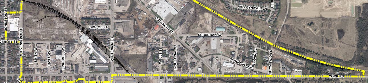
The City initiated a land use study (completed in May 2021) and a draft urban design concept plan for the area generally bound by York Road, the CN rail line and Stevenson Street in Guelph. The land use study considers:
- land use along York Road, Victoria Road and Stevenson Street
- appropriate land uses along the rail corridor
- identifying redevelopment and intensification opportunities
- determining the suitable amount of employment lands in the study area
- examining the mixed business and service/commercial land use designations
- the transition between residential and non-residential uses
- identification of cultural heritage resources and adding properties to the municipal heritage register
The study develops a coordinated approach for the future of this area and will inform Guelph’s Official Plan update.
Videos
-
 This presentation outlines the draft urban design concepts for three demonstration sites within the study area.
-
 York Road/Elizabeth Street Land Use Study - Background Report Presentation
Documents
-
 Draft York Road Elizabeth Street Urban Design Concepts (1.81 MB) (pdf)
-
Background Report
-
Background Report Presentation
-
Background Report Transcript.pdf (292 KB) (pdf)
-
2021-01-28 Cultural Heritage in York-Elizabeth for EHQ_FINAL.pdf (594 KB) (pdf)
-
York Road Elizabeth Street Draft Land Use Study
-
Approved York Road/Elizabeth Street Land Use Study

Who's Listening
-

Email david.degroot@guelph.ca